The claimant said the water damage happened on a Thursday afternoon while they were at work. The photos they submitted to support the claim told a different story — including the exact GPS coordinates where the photos were taken and a timestamp that didn’t match the stated date of loss by several weeks.
EXIF metadata analysis is one of the most accessible and consistently underestimated tools in civil forensic investigation. Most people don’t know their photos carry embedded metadata. Many who do know assume metadata can be easily fabricated. Both assumptions work in favor of investigators who know how to read and validate image metadata correctly.
This is a composite illustration based on patterns common to photo-based insurance fraud investigations. The scenario represents how these cases typically develop, not a specific client matter.
What EXIF Metadata Contains
EXIF stands for Exchangeable Image File Format — a standard for embedding metadata within digital image files. Almost every photo taken with a smartphone or digital camera since the mid-2000s contains an EXIF block.
The metadata categories relevant to fraud investigation:
Timestamps. Three timestamps typically appear: `DateTimeOriginal` (when the shutter fired), `DateTimeDigitized` (when the image was digitized, usually the same as original for direct digital capture), and `DateTime` (last modification time). For fraud investigation, `DateTimeOriginal` is the primary timestamp — it’s written by the camera at capture and doesn’t change with file transfers or copies. It can be modified by editing software, which is why corroboration matters.
GPS coordinates. When location services are enabled on a smartphone, EXIF captures latitude (`GPSLatitude`), longitude (`GPSLongitude`), altitude (`GPSAltitude`), and timestamp (`GPSDateStamp`, `GPSTimeStamp`). The GPS timestamp is recorded in UTC independently of the device’s local time setting — this distinction matters for cross-referencing against other records.
Device identification. `Make` and `Model` fields record the camera manufacturer and model. `Software` records the processing software (iOS version, Android version, or camera firmware). `LensModel` for DSLR/mirrorless cameras. Together these fields identify the specific type of device that took the photo.
Image settings. Exposure time, aperture, ISO, flash status, focal length — these are primarily useful for validating that image settings are consistent with the lighting conditions claimed.
Unique identifiers. Some cameras embed a unique body serial number in the EXIF data. Smartphones often embed device-specific identifiers. These can link a photo to a specific device with high confidence.
The Pattern in Property Damage Claims
Property damage insurance fraud involving photo manipulation falls into a few recurring patterns.
Staged damage photos. The claimant photographs actual damage — but from a different property, a different incident, or a different date. EXIF timestamps and GPS coordinates contradict the claimed date of loss and/or location.
Borrowed photos. Images sourced from the internet or from other claims, sometimes with metadata stripped and sometimes not. Reverse image search (Google Images, TinEye) combined with metadata analysis catches this pattern.
Date manipulation. Accurate location, correct property — but the photo was taken before the claimed damage event, or after the claimed discovery. The claimant attempts to present pre-existing damage as new loss, or to backdate a claim they filed late.
Missing metadata. Legitimate photos taken with modern smartphones should have EXIF data. A collection of photos submitted with no metadata is itself suspicious — metadata stripping is not a default behavior of standard camera apps.
In the pattern we’re examining here, the issue was timestamps and GPS coordinates that didn’t align with the claim narrative.
Working the Investigation
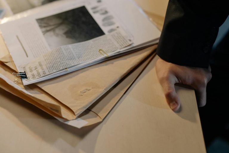
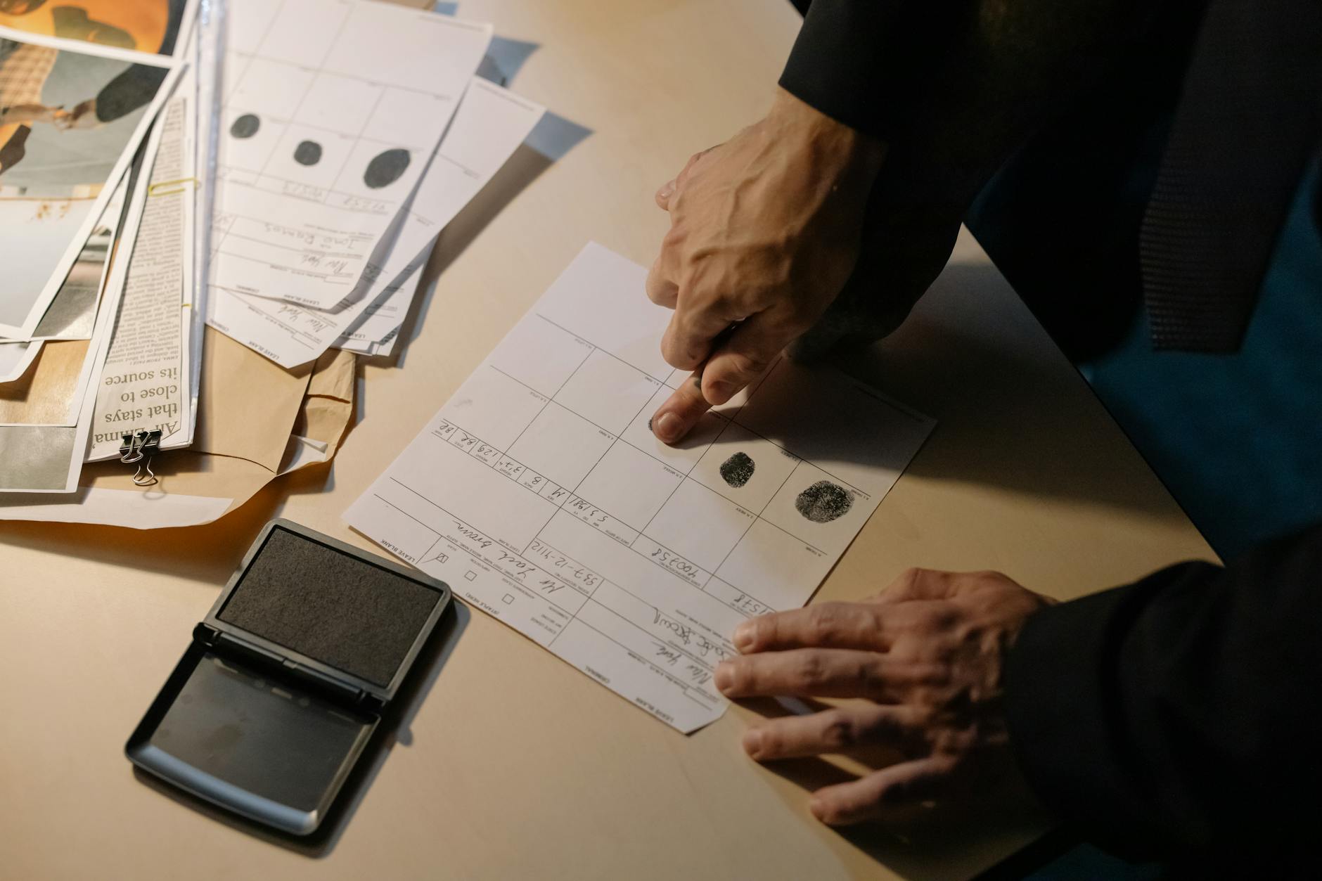
The referral came from an insurance carrier’s special investigations unit (SIU). The claim involved property damage to a residential rental unit — specifically, water damage from an alleged burst pipe. The claimant submitted 14 photographs of the damaged property.
The SIU’s initial concern was the delay between the reported date of loss and the claim filing. But the photographs added a different dimension.
Step 1: Extract metadata from all submitted images.
We used ExifTool — the industry standard open-source tool for EXIF analysis — to extract metadata from all 14 photos. ExifTool outputs every available metadata field. We ran it with the `-a -u -g1` flags to show all duplicate tags, unknown tags, and group them by information type:
“`
exiftool -a -u -g1 *.jpg > metadata_output.txt
“`
The output showed EXIF data present in all 14 images. Good — no evidence of metadata stripping.
Step 2: Check timestamp consistency.
`DateTimeOriginal` across the 14 images fell into two clusters: eight photos with timestamps on one date, six photos with timestamps on a date 22 days later.
The date of loss stated in the claim fell between these two clusters — after all eight early photos and before all six later photos.
This was the first significant anomaly. If all 14 photos documented the same damage event, we’d expect their timestamps to cluster around the date of loss, not around two separate dates that bracket it.
Step 3: Cross-reference GPS data.
All 14 images contained GPS coordinates. We mapped them.
The eight early photos — GPS coordinates placed them at the claimed property address. Consistent with documenting the property.
Four of the six later photos — GPS coordinates also placed them at the claimed property address.
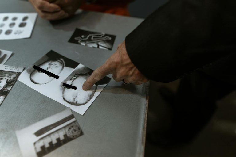
The remaining two photos from the second cluster — GPS coordinates placed them approximately 340 miles away from the claimed property. Different city.
Those two photos were the images the claimant had used to document the “most severe” damage areas, included prominently in the claim documentation.
Step 4: Verify GPS accuracy with corroborating data.
GPS coordinates from smartphone photos are not always perfectly accurate — they can reflect cached location from a prior GPS fix, or can be imprecise in weak-signal environments. We verified the coordinates against the visible content of the photos.
One photo showed a wall with a window. The GPS coordinates placed it in a different city. We examined the window view: visible elements (architectural style, signage visible outside) were consistent with the second location, not with the claimed property address. The GPS was accurate.
Step 5: Device identification analysis.
All 14 photos were taken with the same make and model of smartphone — consistent with one person taking all the photos. The EXIF `Software` field showed the same iOS version across all images, suggesting they were all processed through the same device at similar points in time.
However, a deeper look at the two anomalous photos revealed a slightly different color profile embedded in the file — consistent with images that had been processed through a photo editing application at some point, unlike the other 12 images which showed direct camera capture signatures.
Report Documentation for Insurance SIU
The SIU needed a report that their adjusters, attorneys, and potentially a jury could understand without forensic training. We structured it around three questions:
- Do the photo timestamps match the claimed date of loss?
- Do the photo GPS coordinates match the claimed property location?
- Are there technical indicators of photo manipulation?
Findings on timestamp alignment: Eight photos predated the claim’s date of loss by three to four weeks. Six photos were taken after the date of loss. No photos were taken within a 48-hour window around the claimed date of loss.
Findings on GPS alignment: Twelve of 14 photos were consistent with the claimed property location. Two photos — presented as documentation of the most severe damage areas — were taken approximately 340 miles from the claimed property.
Findings on manipulation indicators: The two GPS-anomalous photos showed color profile characteristics consistent with image editing software processing, unlike the other 12 images. We noted this as a finding without asserting definitively that manipulation occurred — the color profile difference has alternative explanations. The GPS data and timestamp data were the stronger findings.
What we did not conclude: We did not assert that insurance fraud occurred. We documented what the metadata showed. The conclusion that fraud occurred — that the photos were fraudulently submitted as documentation of a claim they didn’t support — is a legal conclusion that belongs to the carrier, their attorneys, and ultimately a fact-finder.
This is an important line to hold. Forensic examiners who editorialize past their findings damage their credibility. “The GPS coordinates in these two images place them 340 miles from the claimed property” is a forensic finding. “The claimant committed fraud” is not a forensic finding.
Metadata Validation: Is What You’re Reading Accurate?
A recurring challenge in EXIF analysis is verifying that the metadata you’re reading reflects actual capture conditions rather than post-capture modification.
Several validation approaches:
Check internal consistency. Do the EXIF timestamp fields agree with each other? `DateTimeOriginal`, `DateTimeDigitized`, and `DateTime` should be consistent for direct-capture images. Significant disagreement — particularly where `DateTime` is much later than `DateTimeOriginal` — indicates the file was modified after capture.
GPS timestamp vs. EXIF timestamp. `GPSDateStamp` and `GPSTimeStamp` are recorded from the GPS hardware independently of the device clock. If the device clock was intentionally set to a wrong date and time, the GPS timestamp may disagree. This discrepancy is a red flag for intentional timestamp manipulation.
File system timestamps. The file’s created, modified, and accessed timestamps in the filesystem can be compared against EXIF internal timestamps. Note that file system timestamps change during file copies and transfers, so they’re less reliable than EXIF internal timestamps — but significant discrepancies warrant documentation.
Pixel-level analysis for manipulation. Error level analysis (ELA) and noise analysis can sometimes detect composite images or selectively edited regions. These techniques require more specialized expertise and are more subjective than metadata analysis — approach them carefully and be precise about confidence levels if you include them in a report.
Cross-reference with external records. The strongest validation is corroboration: do the GPS coordinates match a recognizable location visible in the photo content? Does the timestamp match weather records, security camera logs, or other independent data for the claimed location and time? External corroboration transforms a metadata finding from “the camera said this” to “the camera said this and independent evidence confirms it.”
Tool Recommendations
ExifTool (Phil Harvey) — The most complete EXIF/IPTC/XMP extraction tool available. Command-line, free, open-source, handles hundreds of file formats. Essential for any image metadata analysis. Run it as part of your standard intake process on every image submission.
Jeffrey’s Exif Viewer — Web-based tool useful for quick individual image checks. Presents ExifTool output in a more readable format. Good for initial review, not for formal examination.
Hachoir and exiftool in Python — Scripting metadata extraction across hundreds of images. When you have a large photo submission, automated processing is far faster than manual review.
Google Maps / Earth — For verifying GPS coordinates against visible terrain, buildings, and addresses in the image.
FotoForensics — Web-based error level analysis and metadata viewer. ELA results require careful interpretation; useful as a supplementary check rather than a primary finding.
Frequently Asked Questions
Can EXIF metadata be easily faked or modified?
Yes — metadata can be modified with freely available tools. ExifTool itself can write EXIF data. The question for forensic examination isn’t whether metadata can be modified in principle, but whether it shows signs of modification in this specific instance, and whether independent corroboration supports or contradicts what the metadata shows. This is why we look for internal consistency (multiple timestamp fields agreeing), GPS-to-content correlation (coordinates matching visible photo content), and external corroboration (weather records, building records, etc.). A well-constructed fake is possible; most fraud attempts are not well-constructed.
What should investigators do when photos have no EXIF data?
Absence of metadata is itself a finding worth documenting. Most modern smartphone cameras embed EXIF data by default. Photos with no metadata have either been processed through a metadata-stripping tool, shared through a platform that strips metadata (many social media platforms remove EXIF before serving images), or taken with an unusual camera configuration. In an insurance fraud investigation context, the relevant question is how the claimant obtained and submitted the photos — if they were downloaded from a web source, metadata would typically be stripped. Request the original device and original capture if possible.
Does sharing photos through email or messaging apps affect EXIF data?
It depends on the platform. Direct email attachments generally preserve EXIF data. iMessage and WhatsApp on iOS often reduce image quality and may strip some metadata. MMS often strips metadata entirely. Social media platforms (Instagram, Facebook, Twitter/X) strip EXIF data before serving images. If photos were submitted to an insurance claim after passing through a social media platform, the original metadata is gone — you need the original file from the capture device. Document the chain of custody for the image files as part of your intake process.
How do you handle GPS accuracy issues in your report?
State the precision. EXIF GPS data includes a `GPSHDilution` value indicating positioning accuracy — lower is better, with values under 1.0 representing very high accuracy and values above 5.0 representing poor accuracy. Smartphone GPS is generally accurate to 3-5 meters in open environments, less accurate indoors or in dense urban areas. In a report, present GPS coordinates with their accuracy context: “GPS coordinates in the image place the capture location at [coordinates], consistent with [address], within approximately [X] meters of precision as indicated by the HDOP value.” Don’t claim street-address-level precision when the data supports block-level precision.
Is EXIF analysis alone sufficient to support an insurance fraud finding?
No. EXIF analysis is one component of a broader investigation. Metadata findings need to be corroborated by additional evidence — phone records placing the claimant at the alternate location, reverse image search confirming the image originated from another source, witness testimony, or other physical evidence. Present EXIF findings as one thread in a larger fabric. A carrier’s SIU or defense attorney will build the complete case; the forensic examiner contributes the technical component.